
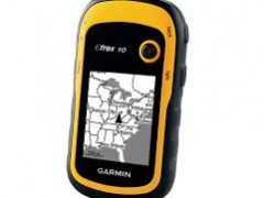

Spesifikasi - Garmin eTrex 10
|
Physical & Performance: |
|
|
Unit dimensions, WxHxD: |
2.1" x 4.0" x 1.3" (5.4 x 10.3 x 3.3 cm) |
|
Display size, WxH: |
1.4" x 1.7" (3.6 x 4.3 cm); 2.2" diag (5.6 cm) |
|
Display resolution, WxH: |
128 x 160 pixels |
|
Display type: |
transflective, monochrome |
|
Weight: |
5 oz (141.7 g) with batteries |
|
Battery: |
2 AA batteries (not included); NiMH or Lithium recommended |
|
Battery life: |
25 hours |
|
Waterproof: |
yes (IPX7) |
|
Floats: |
no |
|
High-sensitivity receiver: |
yes |
|
Interface: |
USB |
|
Maps & Memory: |
|
|
Basemap: |
yes |
|
Preloaded maps: |
no |
|
Ability to add maps: |
no |
|
Built-in memory: |
no |
|
Accepts data cards: |
no |
|
Waypoints/favorites/locations: |
1000 |
|
Routes: |
50 |
|
Track log: |
10,000 points, 100 saved tracks |
|
Features & Benefits: |
|
|
Automatic routing (turn by turn routing on roads): |
no |
|
Electronic compass: |
no |
|
Touchscreen: |
no |
|
Barometric altimeter: |
no |
|
Camera: |
no |
|
Geocaching-friendly: |
yes (paperless) |
|
Custom maps compatible: |
no |
|
Photo navigation (navigate to geotagged photos): |
no |
|
Outdoor GPS games: |
no |
|
Hunt/fish calendar: |
yes |
|
Sun and moon information: |
yes |
|
Tide tables: |
no |
|
Area calculation: |
yes |
|
Custom POIs (ability to add additional points of interest): |
yes |
|
Unit-to-unit transfer (shares data wirelessly with similar units): |
no |
|
Picture viewer: |
no |
|
Garmin Connect™ compatible (online community where you analyze, categorize and share data): |
yes |